
Image Geo-referencing made easy
- Gareth Shedden

- Jan 2, 2022
- 1 min read
Updated: Mar 29, 2022
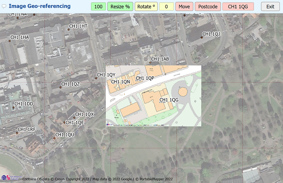
Further to our previous post about DXF Geo-referencing we have a similar problem with Image Geo-referencing too. You've been provided with a site plan image overlay with no Co-ordinates on it, no Scale, Scalebar or even a North arrow. And despite wanting to send the drawing back to be corrected you just don't have the time.
However, what if you could place the image by Postcode as you probably have that. Portable Mapper have written a dedicated tool for this too. Simply open your image and enter the Postcode. Straight away the image is moved just above the postcode area so now all you have to do is, using the Move, Rotate and Resize buttons fine tune the position of your image. There's popup guidance notes when you hover over the buttons too. Once done the image is attached with a geo-referencing tag file so in future simply drag and drop the image in and it'll appear in the right place.

Comments